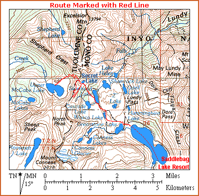
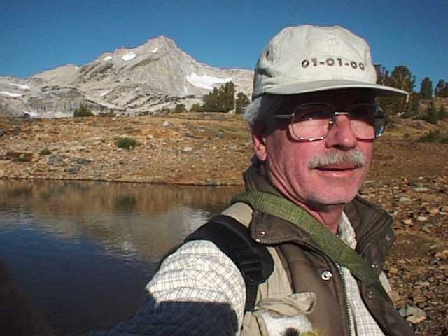
| 008. Moving slightly closer to Mt. Conness, I stop once more to record an image. It's easy to be drawn off-track when you're traveling alone with no one around to change your mind and keep you going according to plan. I call this extemporaneous behavior "existing in a state of free-fall" and I like it! Always highly maneuverable, I start or stop at the drop of a hat... but that fails to attract the patronage of corporate sponsors. - 08:48AM |
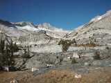 |
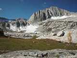
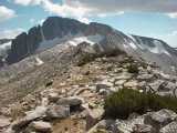
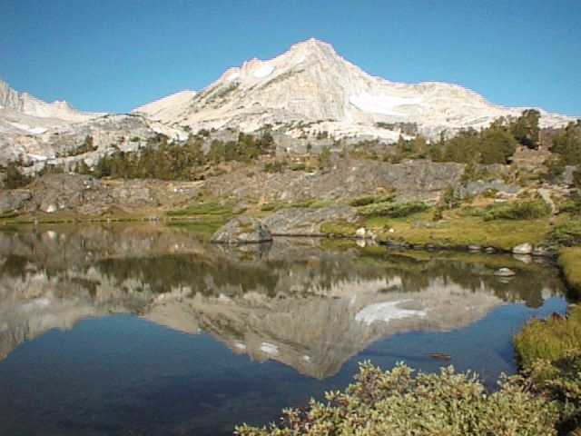
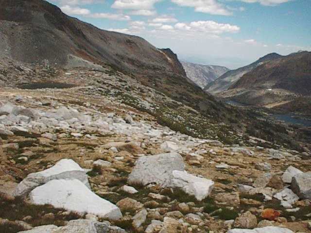
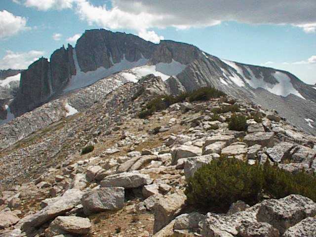
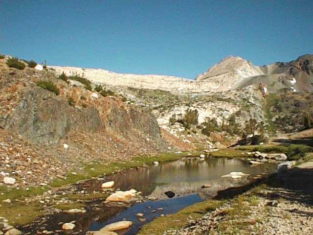
| 009. Now back on course again, I rejoin the loop trail just north of Wasco Lake. An old mining road heads north toward Steelhead Lake, but I'll break away just ahead and begin the ascent toward Secret Lake which rests in a cirque, a steep-walled horseshoe-shaped recess high on a mountain that is formed by glacial erosion. That high peak ahead (el. 11,865 feet) is unnamed but is a part of the ridge called Shepard Crest. - 09:05AM |
 |
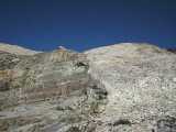
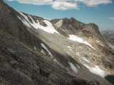
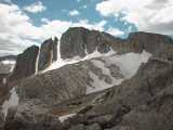
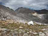
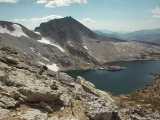
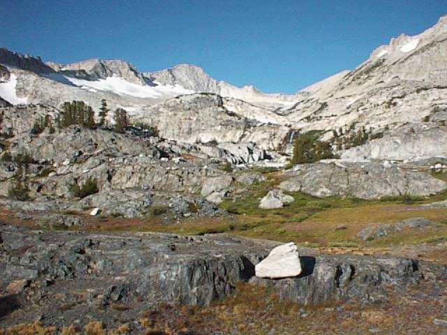
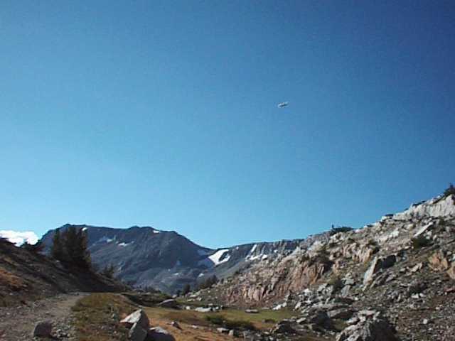
| 010. Traveling forward only a few steps, I encounter yet another distraction. It's the unmistakable sound of a twin engine light aircraft approaching from a low angle and there's no landing strip in the area. What's the deal? Look carefully at the larger photo and see if you can spot a small white object appearing directly below the darker peak, just to the right of a snowfield. It looks like it may be a small patch of snow, but you won't find it on the previous photo. - 09:06AM |
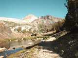 |
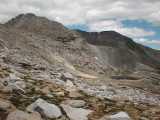
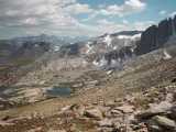
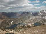
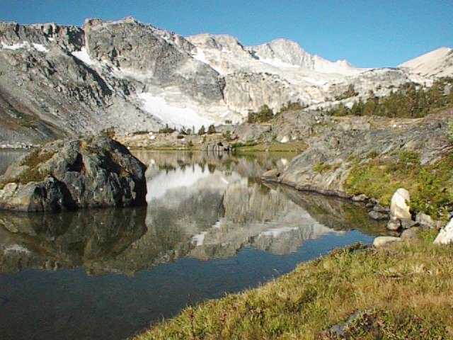
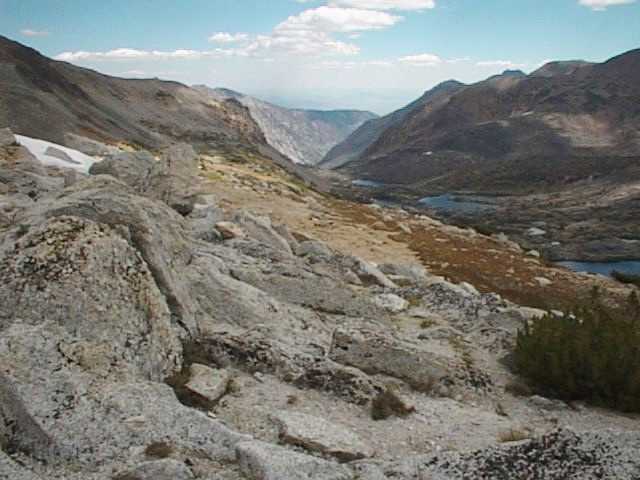
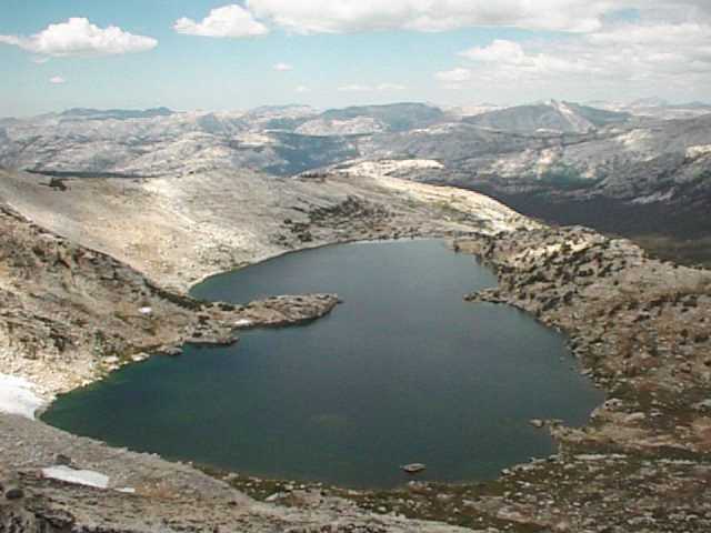
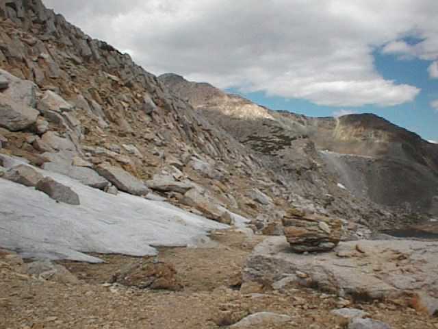
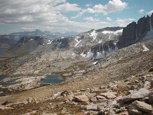
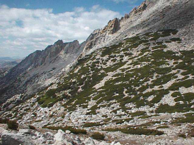
| 011. Barely visible, the plane makes a low pass at Secret Lake and out from the belly of the beast squirts a spray of fingerling trout. Secret Lake is perhaps a few acres in area and at an elevation of 10,882 feet, it freezes solid during the winter. I am baffled as to why the California Department of Fish and Game is stocking this lake with trout. Secret Lake, my first destination, sits to the right above the green area and below the light-colored rock ridge near the center of this photo. - 09:06AM |
|
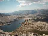
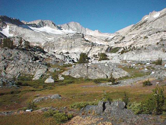
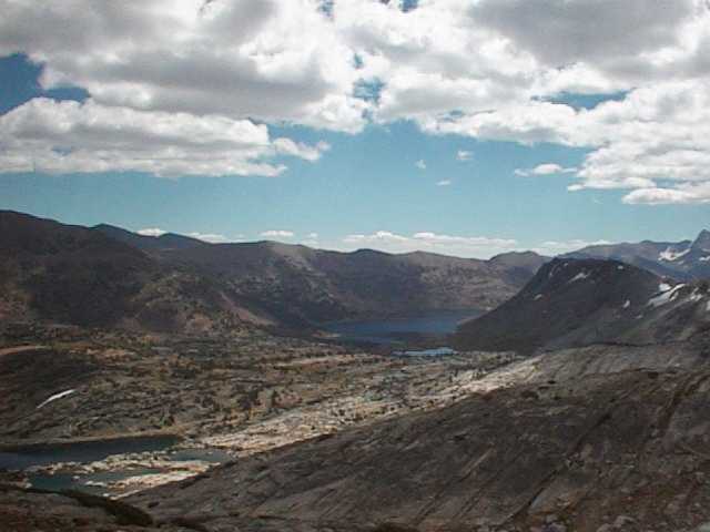
| 012. The plane, seen overhead, circles back over Saddlebag Lake and prepares to make another run at other lakes within the Twenty Lakes Basin. Saddlebag Lake is stocked with pan-size Rainbow Trout during the summer season. Each week 2,000 pounds of 8 to 12 inch fish are delivered by tanker truck from the hatchery at Hot Creek. If you can't catch trout in Saddlebag Lake, perhaps you should go take up golf. - 09:07AM |
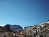 |
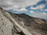
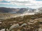
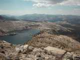
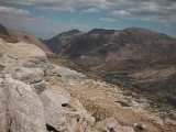
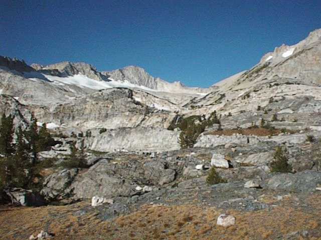
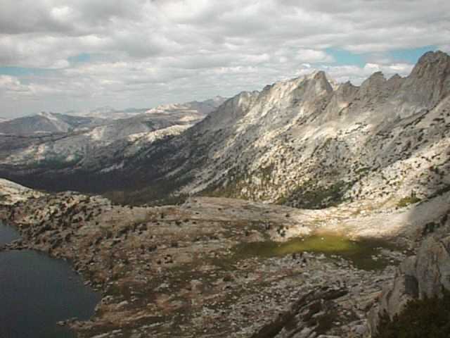
| 013. The plane, clearly seen flying low just below the peak in the center of the photo, banks to make a pass at stocking nearby Steelhead Lake. Soon I'll be passing Steelhead Lake above its southwest shore, crossing Mill Creek and walking around the north shore of a pond (seen in the next photo) near Cascade Lake. There I'll begin the serious business of hiking 1/2 mile up the trail, gaining 525 feet of elevation on a 20% average grade to reach Secret Lake. - 09:09AM |
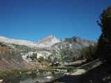 |
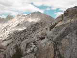
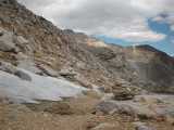
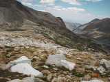
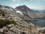
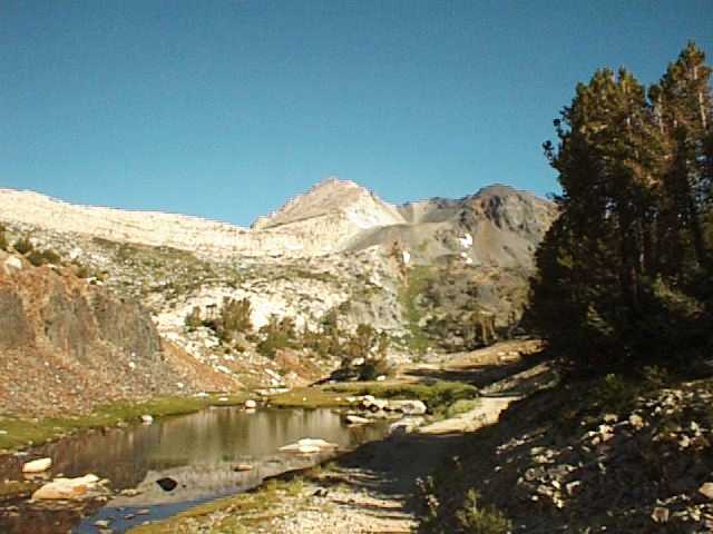
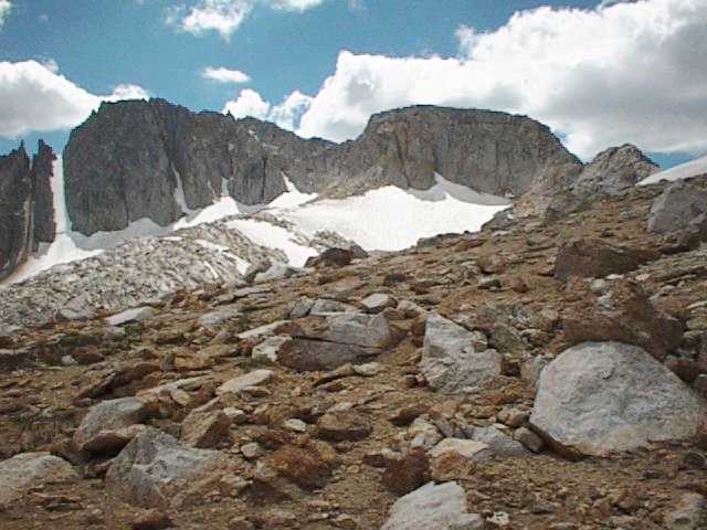
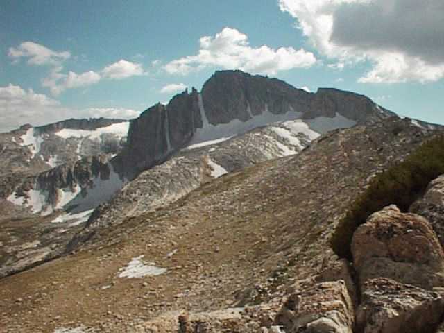
| 014. Here's where the real hike begins. The previous ground covered was just a walk in the park -- a warm up exercise. I can't seem to shake a low-grade headache which strikes me at altitudes above 9,000 feet. But that doesn't matter as I gaze up at North Peak, now showing its broadside from this location. Later, from the crest above, I'll be viewing this 12,242 foot peak from a much closer range. The meadows at this altitude are still green, reminiscent of springtime at lower elevations. - 09:47AM |
 |
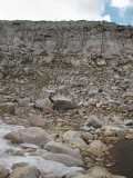
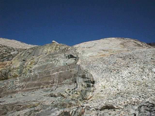
| 015. Rocks set in gold bands and worn on fingers may seem more elegant than what you're looking at here, but in my opinion, diamonds are not nearly as fascinating as this fine specimen. This is a rock outcropping where a seam divides two very different rocks of different ages. On the left it shows stratification, the roots of the ancient Sierra. On the right side it's relatively new granite, the stuff that makes up the modern Sierra Nevada range. I'd sure like to see how that was done. Oh well, it's high time I got on with it and gained more altitude. - 09:48AM |
 |
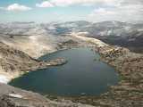
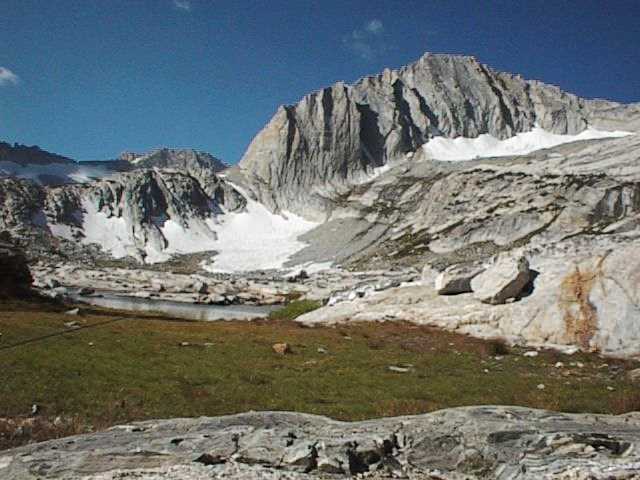
| 016. More than two hours have passed since I've had the camera out. I've been picking my way up to the Sierra Crest where I stand looking northwest, down the west side at Upper McCabe Lake. However, the journey has not been without a minor set back. While the lake seems rather close, it's a long way down from where I'm standing -- a drop of 750 feet over a horizontal distance of 1/4 mile to the nearest shore. That's an average grade of 52%, much too steep for me to descend safely. - 11:54AM |
 |
| 017. Turning to look northeast in the direction from which I've just ascended, the upper end of Steelhead Lake comes into view. Shamrock Lake, Lake Helen and Lundy Canyon appear off in the distance. Even with all the particulate matter in the air from several wildfires burning in the western states, I can still see for a hundred miles, beyond the northern shore of Mono Lake, out to the Nevada desert. - 11:54AM |
 |
| 018. Clouds are moving in... I hear thunder bumpers echoing through the canyons and it's cold up here at 11,225 feet. Never mind, on with the vest, light up a cigar and let's enjoy the view. You're looking southeast toward Greenstone Lake and the north end of Saddlebag Lake. On the right we're looking across the top of a dark, nameless mountain standing at 11,239 by Saddlebag Lake, and at the extreme right, the sharp 13,057 peak of Mt. Dana looms on the distant horizon. - 11:54AM |
 |
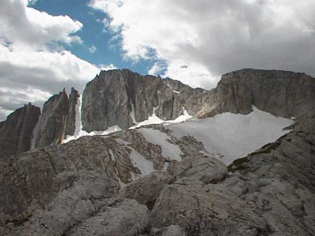
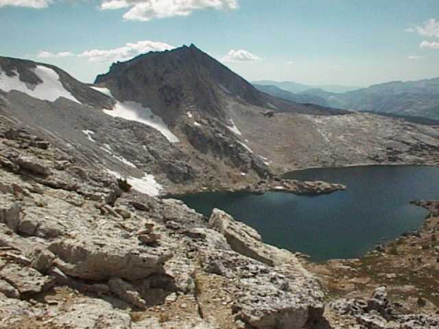
| 019. Turning south, North Peak dominates the view with permanent snow fields clinging to the crevices. This will be as close as I will get to its summit, still towering 600 feet above me. Isn't it odd that employers allow time off of work to serve on jury duty, but frown on giving up some time to get a load of this magnificent sight? I am reminded of all the Worker Bees�, lower down the slopes, holding their noses to the grindstone, making honey to pay the rent or reduce their awesome mortgages while I'm up here goofing off all alone with the Howlin' Wolvies.� - 11:54AM |
 |
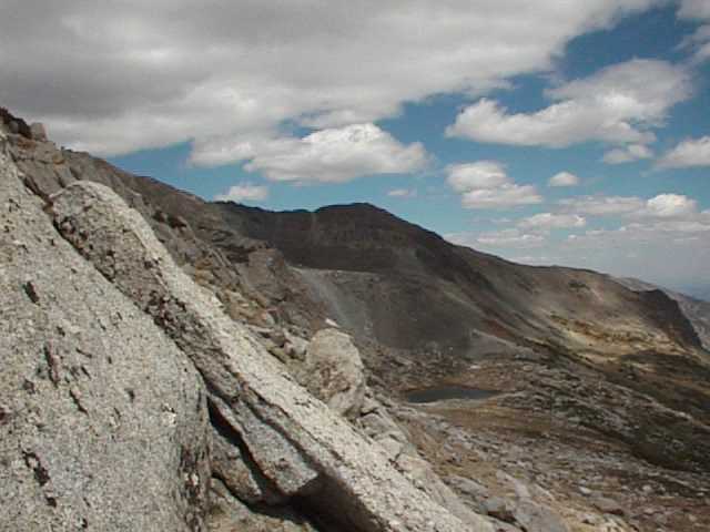
| 020. It's taken three quarters of an hour for me to drop nearly a hundred feet down from the ridge line, move a hundred yards north and take another cut up to the crest. Hopefully I'll be able to get down to McCabe Lake from this position, but once again I'm disappointed. Here I begin to focus on the slope leading up from the south shore of Upper McCabe Lake (lower right), surveying the permanent ice field above which must be crossed to gain the 11,230 foot pass leading to Roosevelt Lake, my intended target for another day. - 12:40PM |
 |
| 021. Once again I'm looking over the top at Upper McCabe Lake, this time from a more northerly position on the crest. Again, I'm denied a sure way down, and each time I rise back to the top, it's almost like climbing the side of a 10 or 12 story building. Through field glasses I can see faint rings left by lunker trout, snapping up flies from the surface like candy. Now approaching 1:00 PM and still not having eaten lunch, hopes of reaching this destination are quickly fading. I've arranged to have the water taxi pick me up at the north shore of Saddlebag Lake at 5:15 PM and precious time is ticking away. - 12:40PM |
 |
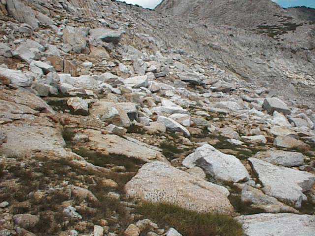
| 022. Looking north I see where I could descend safely to the lake but I'm still several hundred yards short of the pass. I've been told to look for a metal sign which reads, "Welcome to Yosemite -- No Guns or Campfires Allowed" as that marks the boundary and the place where I should begin my descent. There's no trail once you pass Secret Lake. During most of the year this place is covered with snow, and wind or rain quickly erases any signs of previous passage. It's cross-country, you pick your way along, scrambling over or around rocks and boulders. - 12:40PM |
 |
| 023. Taking a position slightly down from the crest on the west side, the saddle where I should cross over the ridge comes into view. Looking north beyond the pass is Shepard Crest, framing the north side of Upper McCabe Lake. I'm starting to acquire a knack for creaching around and over the rocks, looking for crushed granite and turf where footing is easy. It isn't as bad as you think, but I would be most grateful if my legs were just a few inches longer. - 12:44PM |
 |
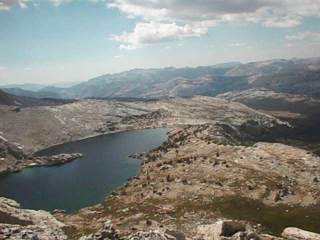
| 024. It's not that the clouds have gotten any lower... I've just been moving higher. This is the high point of the ridge, 11,500 feet above sea level. Looking southeast, Cascade, Greenstone and Saddlebag Lakes are all in view. The sharp peak on the horizon is Mt. Dana where headwaters from the Dana Fork of the Tuolumne River flow to join the Lyell Fork at Tuolumne Meadows in Yosemite National Park. - 12:51PM |
 |
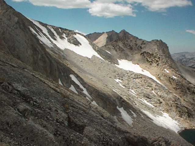
| 025. North Peak dominates the landscape from this southern view. I will move further north along the crest to gain a better view of the saddle where it's safe to cross over and descend to McCabe Lake. It's impossible to travel north along the crest at this point as the ridge is steep on each side and the some of the boulders on top are as big as Cadillacs. I'll have to drop down again on the east side, move north several hundred yards, and take a diagonal cut leading back up to the crest. - 12:51PM |
 |
| 026. Moving off the crest now, looking down and to the northeast, Secret Lake seems comfortably perched in its cirque at 10,882 feet. The slope here is still too steep to allow good passage ahead on a route leading back up the ridge. I'll move still further down the slope at this point and walk north before taking another run back up to the crest. - 01:03PM |
 |
| 027. Down at the level where I could begin a diagonal cut back to the crest, trail markers can be seen -- rocks piled atop one another. They mean nothing more that someone else has passed this way before. I will move further out and away from the crest, advancing forward before taking another shot at the ridge. Even in late summer, snow can linger in scattered patches at this elevation and melt water continues to feed Secret Lake ahead. - 01:09PM |
 |
| 028. Looking toward North Peak and back over the route where I took my first cut up to the crest, it's clear why I made that choice. Covering a greater distance, the slope is gentle and the going was easy. From Steelhead Lake below, Lee and I had observed a small party of hikers take this route up to the crest weeks earlier, and I was inclined to think this was the way to go, not knowing of the sheer drop off on the east side. - 01:09PM |
 |
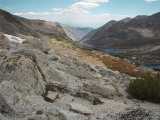
| 029. Several hundred yards of rock rubble lay stacked between me and the crossing that's sparsely covered with low vegetation. I need to advance forward now to see around the bulge ahead which blocks my view of a route back to the crest. I can imagine how tedious it was for early explorers to find their way through these high mountain passes. The south end of Secret Lake is visible at the extreme right of this photo. - 01:17PM |
 |
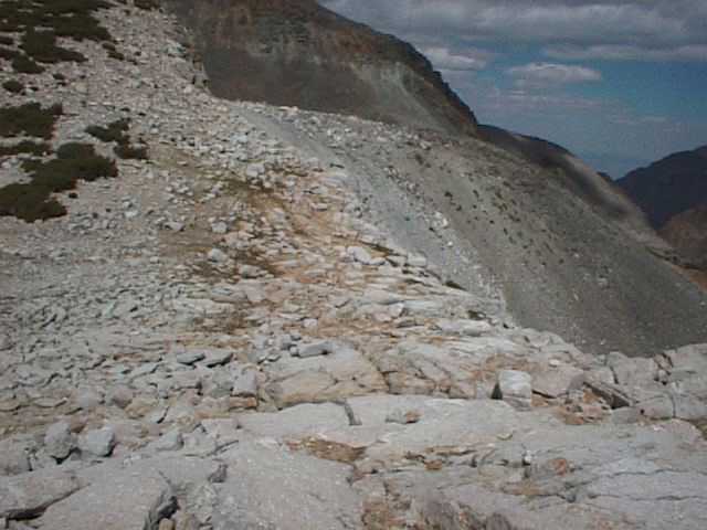
| 030. I've found a point where the view up to the saddle is unobstructed. This is not a difficult route, but large boulders can be tricky. You can't pick the exact path up to the top from here. It's best to look ahead, 20 to 40 feet, and then decide when it's best to go over or around rocks and boulders. There are certain clues to observe. It's easy going over crushed granite where low turf tends to grow. - 01:23PM |
|
| 031. It's a choice between the longer, easy-going path ahead where the slope's more gentle, or taking the shorter but steeper ascent above Secret Lake to the crest. I'll move in closer to Secret Lake and take the shorter, steeper route to the top. One of my objectives on this trek is to get some stress conditioning, so I'm packing about 25 pounds of gear along with the fishing rod. I have no plans to stay out here overnight. - 01:23PM |
 |
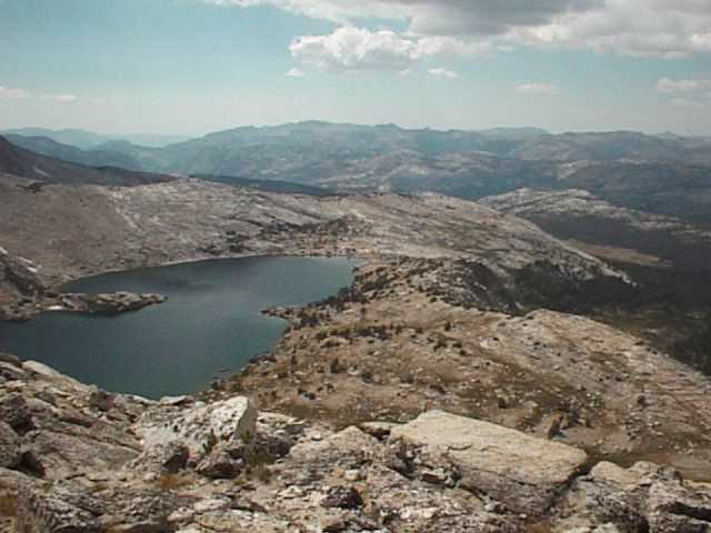
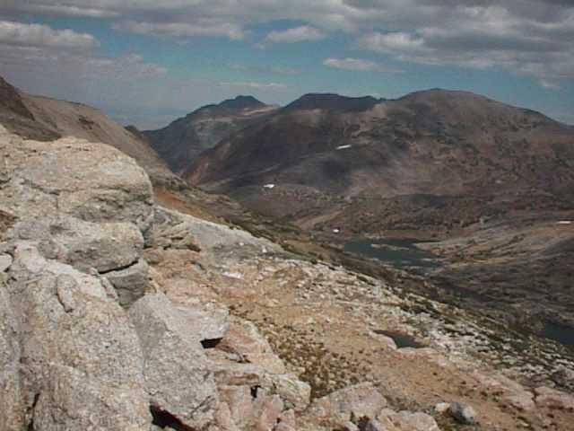
| 032. Looking back towards Saddlebag Lake, Mt. Dana looms on the distant horizon. I am standing on ground that's covered with snow nine months of the year. Usually by late July the snow's melted away to make this area reasonably accessible. The first snow could fall anytime during September, or as late as November. Back at Saddlebag Lake, the resort will close for the winter by October 1st. - 01:24PM |
 |
| 033. Drawing closer to Secret Lake, Lundy Canyon can be seen in the northeast. Shamrock and Helen Lakes are also in view, both of which are well populated by wild species of Golden and Brook trout. I'm standing about where I was an hour and a half earlier before being up to the crest twice. This hunt for the crossing took me farther, required a greater expenditure of energy, and has taken longer than the descent from the crest down to Upper McCabe Lake. - 01:25PM |
 |
| 034. Reaching the crest for the third time, I look toward the southern end of Upper McCabe Lake. No point in hauling lunch around any longer, so this is where I'll park it and eat. That's a permanent ice field hanging there in the shadow of this unnamed peak, and since I plan on climbing that obstacle when I return on another trip, I'll move further north along the ridge to get a better view. - 02:34PM |
 |
| 035. Water from Upper McCabe Lake flows to the Tuolumne River, falling about 4,000 feet as the stream travels 11 miles in a southwesterly direction. This watershed eventually drains into the San Francisco Bay. As streams and rivers wind along their course out to the open sea, countless numbers of my finny friends are waiting... many with my name on them. - 02:35PM |
 |
| 036. Here again is the northern end of Upper McCabe Lake. As seen from this position, its outlet stream tumbles down a steep slope beyond the far tip of the lake. There is no trail leading to Upper McCabe Lake and trout seldom find anyone fishing. Lower McCabe Lake (not visible from this location) can be reached from the Pacific Crest Trail heading north, 13 miles out of Tuolumne Meadows. - 02:43PM |
 |
| 037. Here's the best view I'll get of the ice field above Upper McCabe Lake. When I tackle this hazzard on the next trip, I may need a pair of sharp cleats clamped on to my boots. If taken straight on, that's a 40% average grade running a quarter of a mile, with an elevation gain of 525 feet. The pass tops out at 11,230 feet, about the same elevation as where I'm standing now. - 02:44PM |
 |
| 038. A look back at North Peak fading away as I move further north along the crest. Strong winds (the 'Wolvies'), sometimes howl in excess of one hundred miles per hour, sweeping over the crest, sculpting deep ridges into the seams. In spite of this harsh environment where winter temperatures drop below zero, stunted vegetation finds its grip along the margins where plants can still grow. - 02:44PM |
 |
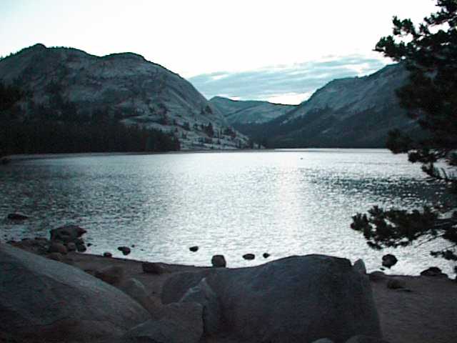
| 039. Cascade Lake is one of several bodies of water within the Twenty Lakes Basin lying north of Saddlebag Lake in Mono County, California. There is no place else on earth where you can fish for colorful Brook, Brown, Rainbow and Golden Trout, all within an easy 15 minute walk of motorized transportation. But the season is short, June to October, when hiking is unhampered by snow. - 02:44PM |
 |
| 040. On the eastern side of the crest, water flows to Secret and Shamrock Lakes, down Lundy Canyon (all shown here) through Lundy Lake and out into Mono Lake which has no outlet. Since 1941, the City of Los Angeles has diverted water from the streams entering Mono Lake, bringing it south through a network of rivers and canals. - 02:45PM |
 |
| 041. This is the saddle on the Sierra Crest overlooking Secret Lake to the east, and Upper McCabe Lake to the west. At last, here's the place I've been seeking to cross over the crest and head down to Upper McCabe Lake. This last leg of the journey must wait for another day. On this day, however, I've learned a lot about scrambling over rocks like a lizard in a garden where air is rare and the views are simply breath-taking. - 03:07PM |
 |
| 042. Looking northwest along Shepard Crest, you can pick your route down from the saddle over a series of switchbacks leading to the northeast shore of Upper McCabe Lake. Next time, I'll pass this way and camp overnight on the shore of Upper McCabe Lake. From that camp, I'll head south on a 2.6 mile hike over to Roosevelt Lake, perhaps one of the most remote and seldom seen places in the region. - 03:08PM |
 |
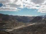
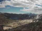
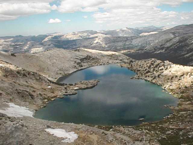
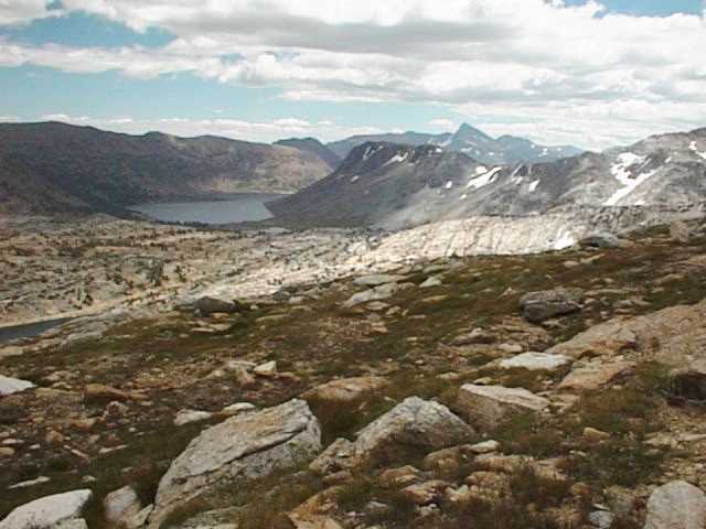
| 043. A view southeast over the Twenty Lakes Basin reveal Secret, Steelhead, Cascade, Wasco, Greenstone and Saddlebag Lakes. An important aspect of the wilderness experience is the quality of solitude; freedom from the intrusion of human sights and sounds. There are no electrical power transmission lines here, and the cell phones and pagers connecting you to another world are useless. This is where you can spend time in another dimension. - 03:11PM |
 |
| 044. One final look back along the ridge line leading south toward North Peak. Wilderness areas are "where earth and its community of life remains untrammeled, where man himself is a visitor who does not remain". Some mark is left in Wilderness each time we visit, but each of us can make sure this mark is a small one. Minimum impact or no trace camping should be considered common sense behavior in the backcountry. - 03:12PM |
 |
045. A brief glance back to the Sierra Crest, 300 feet above the south shore of Secret Lake, here's the route I scrambled down from the crest -- and the one I should have taken first on the way up. From here, it's back down to the water-taxi scheduled to meet me at Saddlebag Lake. By the time the last light has faded in the western sky, I'll be back at Yosemite Riverside Inn resting comfortably in a motel room. - 04:29PM
None of my finny friends gave it up to me this day, yet they know... "I'll be back!"
|
 |
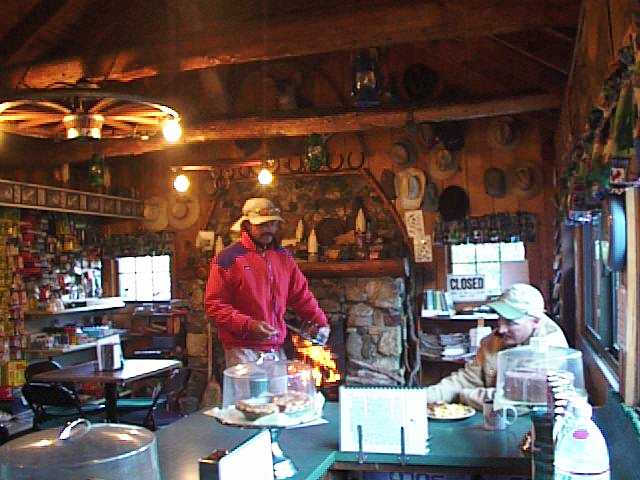
Depending on winter snowpack, this area is generally open from June to October. The resort offers boat rentals, water-taxi service between the north and south ends of the lake, bait and tackle, fishing licenses, souvenirs, supplies, and home cooked meals.
The friendly folks at the resort will gladly provide helpful information on fishing, hiking and obtaining Wilderness Permits for those who plan to stay out in the back country overnight.


